Europe, British Isles, England, North Yorkshire, Boroughbridge [Map]
Boroughbridge is in North Yorkshire.
On 25 Aug 1330 John Mohun (age 30) was killed at Boroughbridge [Map]. He was buried at Dunster, Somerset.
In 1558 William Fairfax (age 27) was elected MP Boroughbridge.
In 1588 Edward Fitton (age 40) was elected MP Boroughbridge.
In 1601 Thomas Fairfax 1st Viscount Fairfax (age 27) was elected MP Boroughbridge.
In 1602 Richard Whalley of Kirton (age 36) was elected MP Boroughbridge.
In 1609 Thomas Vavasour (age 49) was elected MP Boroughbridge.
In 1648 Henry Stapylton aka Stapleton 1st Baronet (age 31) was elected MP Boroughbridge.
In 1660 Henry Stapylton aka Stapleton 1st Baronet (age 43) was elected MP Boroughbridge.
In 1679 John Brookes 1st Baronet (age 42) was elected MP Boroughbridge.
In 1681 John Brookes 1st Baronet (age 44) was elected MP Boroughbridge.
In 1689 Christopher Vane 1st Baron Barnard (age 35) was appointed MP Boroughbridge.
In 1690 Bryan Stapylton 2nd Baronet (age 32) was elected MP Boroughbridge.
In 1705 John Stapylton 3rd Baronet (age 22) was elected MP Boroughbridge, which his father Bryan Stapylton 2nd Baronet (age 47) had represented for twelve of the previous fifteen years.
In 1708 Bryan Stapylton 2nd Baronet (age 50) was elected MP Boroughbridge replacing his son John Stapylton 3rd Baronet (age 25).
In 1715 Bryan Stapylton 2nd Baronet (age 57) was elected MP Boroughbridge.
In 1718 Wilfrid Lawson 3rd Baronet (age 21) was elected MP Boroughbridge.
On 22 Apr 1746 Francis Scott (age 25) was elected MP Boroughbridge.
In 1755 Cecil Bisshopp 6th Baronet (age 54) was elected MP Boroughbridge which seat he held until 1768.
In 1796 Francis Burdett 5th Baronet (age 25) was elected MP Boroughbridge.
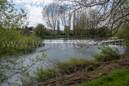
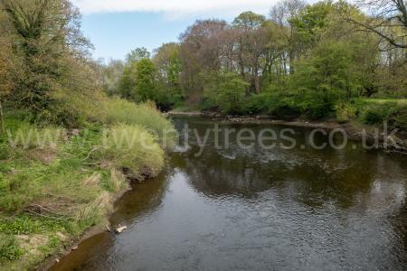
The River Ure rises at Ure Head [Map] after which it over Aysgarth Falls [Map], past Middleham Castle [Map], Jervaulx Abbey [Map], St Nicholas Church, West Tanfield [Map], east of Ripon [Map], under the bridge at Boroughbridge [Map] after which it is joined by the River Swale to form the River Ouse.
Europe, British Isles, England, North Yorkshire, Boroughbridge, Aldborough Roman Site [Map]
From Eboracum aka York [Map] Dere Street travels to Aldborough [Map], Leeming Bar, North Yorkshire [Map], Cataractonium [Map] aka Catterick, Piercebridge, County Durham [Map], Vinovia aka Binchester, County Durham [Map], on the banks of the River Wear, Ebchester, County Durham [Map], where it crosses the County Durham River Derwent, Corbridge Roman Fort, Northumberland [Map], where it, and crosses the River Tyne and Stanegate Roman Road began.
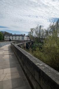
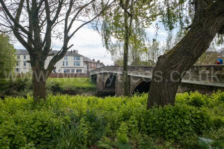
Europe, British Isles, England, North Yorkshire, Boroughbridge Bridge [Map]
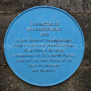
On 16 Mar 1322 the rebel army led by Thomas Plantagenet 2nd Earl of Leicester, 2nd Earl Lancaster, Earl of Salisbury and Lincoln (age 44) attempted to cross the bridge over the River Ure (between Ripon and York) at Boroughbridge Bridge [Map]. Their path was blocked by forces loyal to the King led by Andrew Harclay 1st Earl Carlisle (age 52). Bartholomew Badlesmere 1st Baron Badlesmere (age 46), Roger Mortimer 1st Earl March (age 34), John Botetort 1st Baron Botetort (age 57) and John Maltravers 1st Baron Maltravers (age 32) fought for the rebels. Roger Clifford 2nd Baron Clifford (age 22), Nicholas Longford (age 37), Thomas Plantagenet 2nd Earl of Leicester, 2nd Earl Lancaster, Earl of Salisbury and Lincoln (age 44), John Mowbray 2nd Baron Mowbray (age 35) were captured.


Warin Lisle (age 51) was hanged after the battle at Pontefract [Map].
Following the battle Hugh Audley 1st Earl Gloucester (age 31) and his wife Margaret Clare Countess Gloucester were both imprisoned. He in Nottingham Castle [Map] and she in Sempringham Priory [Map].

John Clinton 2nd Baron Clinton (age 22), Ralph Greystoke 1st Baron Greystoke (age 22), William Latimer 2nd Baron Latimer of Corby (age 46), Robert Lisle 1st Baron Lisle (age 34), Domhnall Mar II Earl Mar (age 29) and Peter Saltmarsh (age 42) fought for the King.


Adam Everingham 1st Baron Everingham of Laxton (age 43) was captured.
Humphrey Bohun 4th Earl Hereford 3rd Earl Essex (age 46) was killed. His son John Bohun 5th Earl Hereford 4th Earl Essex (age 15) succeeded 5th Earl Hereford, 4th Earl Essex.
Europe, British Isles, England, North Yorkshire, Horsefair Boroughbridge [Map]
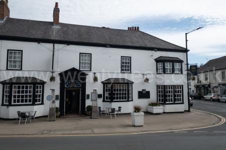
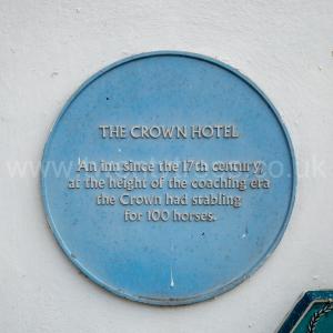
Europe, British Isles, England, North Yorkshire, Horsefair Boroughbridge, Crown Hotel [Map]
Crown Hotel [Map].
Also under Fishergate (north side) Hotel. Site formerly occupied by the Manor House of the Tancred family, remains of which are indicated by the central stone gable section of the Fishergate elevation which contains a four-centred fireplace and blocked window. Otherwise C18 appearance. Rendered. Slate roof. Bridge Street front:- wooden modillion eaves cornice: 2 storeys, 6 bays. Central entrance has wooden doorcase with consoles, cornice and pediment. Iron boot scrapers to either side. Flanking single-storey canted bays and a further 2-storey canted bay to the right. Sash windows with glazing, 1 bars (some original) in architraves. Fishergate front: total of 15 sashes to 1st floor. 6 single-storey bays to ground floor. Central stone gabled section has C20 French doors. Sash windows with glazing bars in architraves. An important coaching inn in the later C18.
Europe, British Isles, England, North Yorkshire, Horsefair Boroughbridge, White Tailor's Shop [Map]
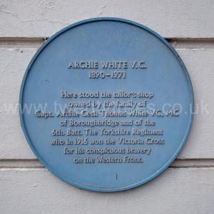
White Tailor's Shop [Map]. Blue Plaque to Archie White VC.
Archie White VC: On 05 Oct 1890 he was born. In 1916 Archie White VC was awarded the Victoria Cross. See The London Gazette 29802 Supplement. On 20 May 1971 he died.
Europe, British Isles, England, North Yorkshire, Boroughbridge, The Devil's Arrow's [Map]
The Devil's Arrow's is also in North England Standing Stones.
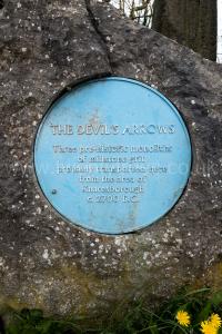
2700BC. The The Devil's Arrow's [Map] are three monoliths, the second highest in England, near Boroughbridge in Yorkshire. The tallest stone is 6.85m high. There are likely to have originally been more. William Camden mentions four stones in his Britannia, noting that "one was lately pulled downe by some that hoped, though in vaine, to finde treasure." The outer stones are 110m and 60m away from the central stone and form an alignment that is almost straight, running NNW-SSE.
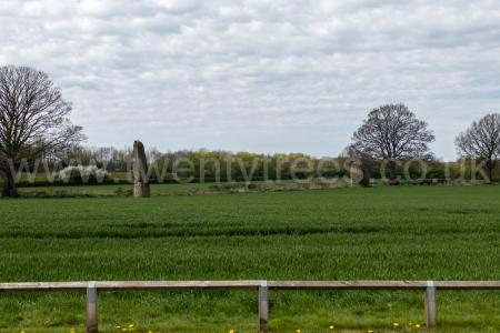
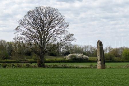
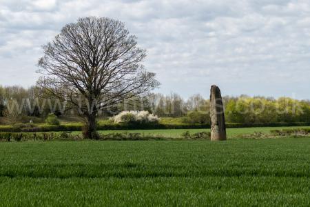
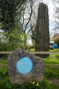
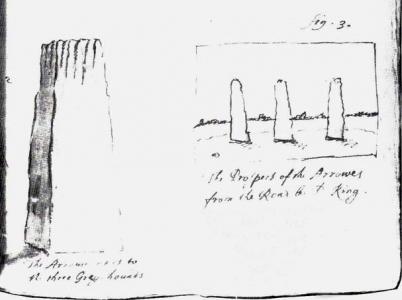 1687. Drawing of the The Devil's Arrow's [Map] by John Aubrey (age 60).
Avebury by William Stukeley. Boroughbridge. The stones, as much famed by the name of the Devil’s Arrows [The Devil's Arrow's [Map]], as misrepresented by writers, stand in some fields, half a mile west of the Roman road south of Boroughbridge. Some think them Roman, though they regard not any Roman work hereabouts: some say they are factitious, though plain stone as possible. They are stones of very large dimensions, and have been hewn pretty square, much as those at Stonehenge; but silly people have knocked off the edges: their height is very great: they were very taper and well-shaped, and much of an obelisk form; but the tops are decayed, and long furrows worn down on all sides along the tenderest part of the grain of the stone. I remarked, that they all lean somewhat southward. The stone is intirely composed of small white crystals, unperishable by weather: they are certainly natural, and brought about ten miles off, from the west, where more such lie above ground in great plenty. Three now stand; one was taken away, as all report, to make a bridge over the bec a little eastward. The cross near the church is of the same stone. These stones stood 200 foot asunder, pretty near in a line north and south: the first stone westward is not so high as the other, but broader much, and stands square, or perpendicular to the line of direction; it is 8½ foot broad, 4½ thick, 23 foot about; the second in the next pasture is square each side, but not precisely; it is 5 foot broad, 4 foot thick, 18 foot fquare: the next is twice as far distant, and beyond the road, of a figure much like the former, but rather higher, as that is higher than the first; this is 5 foot by 4: the two last are very beautiful obelisks, and their height about 25 foot, as I guess. The ground this fine monument stands on is high, and declines every way a little from it; the great river [River Ure], the brook, and some low ground to the south, hem it in as it were. Mr. Gale, and the beforementioned clergyman, some time since dug under one to the foundation, and found that it was about five foot under ground, and fastened into its seat by stones laid in clay, quite around it, as a wall: they put four half-pence, in a leaden box underneath, of queen Anne, Vigo, &c. and filled it up again. I could not commend them for it, as it could only tend to mistead the curious of future times.
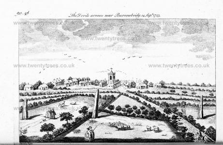
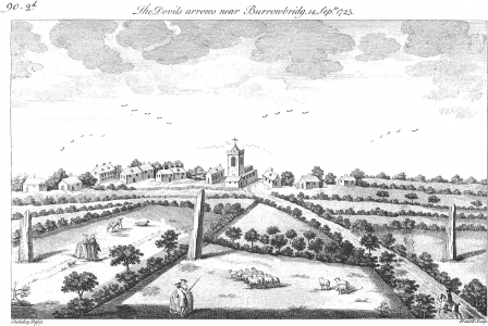 14 Sep 1725. Drawing of the The Devil's Arrow's [Map] by William Stukeley (age 37).
 1895. Drawing of the The Devil's Arrow's [Map] by Percy Robinson.