Europe, British Isles, South-West England, Wiltshire, Fyfield, Clatford Bottom, Devil's Den Long Barrow [Map]
Devil's Den Long Barrow is in Clatford Bottom, Fyfield [Map], Avebury Long Barrows North.
Devil's Den Long Barrow [Map]. Historic England 1012321.
The monument includes an earthen mound and Chambered Tombs set on the floor of a dry valley in an area of undulating chalk downland. The Chambered Tombs comprises four large sarsens (three uprights, one capstone). It is orientated north-west/south-east and set on top of a low earthen mound 8m square and 0.4m high. The sarsen uprights (one of which now lies on its side) range in size from 3-4m square while the capstone is 4m square. Flanking the mound on the north-west and south-east sides are quarry ditches from which material was quarried during the construction of the monument. These are no longer visible at ground level but survive as buried features c.3m wide. The site was partially reconstructed in 1921, after plough damage, and now stands 5m high. A concrete plinth bearing the date '1921' has been inserted on the northern side of the monument.
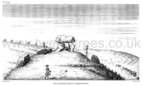
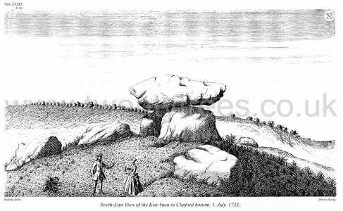
Avebury by William Stukeley. Table XXXII, XXXIII, XXXIV, are views of another eminent work [Devil's Den Long Barrow [Map]] of this sort, in Clatford-bottom between Abury and Marlborough, which require no further description.
Avebury by William Stukeley. Table XXXII. View of the Kist-Vaen [Devil's Den Long Barrow [Map]] in Clatford bottom.
Avebury by William Stukeley. Table XXXIII. North-East View of the Kist-Vaen [Devil's Den Long Barrow [Map]] in Clatford bottom. 1. July. 1723.
Diary of a Dean by Merewether. After the Salisbury meeting, a large party started to inspect Silbury Hill and its interesting neighbourhood, on Tuesday, July the 31st; whilst a few, reaching Marlborough the night before, were ready at an early hour to proceed to the spot. These choice spirits I had the honour to conduct to the noble Cromlech [Map] at Clatford (L), and the other objects so worthy of notice en route as already mentioned in a former page. We had ample time not only to examine Silbury, but to lay in, with due regard to the effects of the pure air of these delightful hungrifying hills, an ample preservative from the well-prepared table of the Misses Sloper, at the Waggon and Horses Inn [Map], from this day denominated by us the Archæological Hotel; not forgetting an important article here to be obtained in perfection, and not by possibility to be surpassed either by the metheglin of old, or by the most approved and long-renowned "cerw dha" [Note. Cerw appears to be Welsh for beer?] itself. Our Salisbury friends not having arrived—for they were the sufferers in one of those disasters which seem to be inevitable concomitants in all such expeditions, first or last, their coach having broken down five miles from the end of their journey, thus regaling them with somewhat more of the refreshing breezes and undulatory prospects of the hills and dales of Wilts than they desired—we, more favoured, were constrained to proceed without them to inspect the stupendous remains at Avebury—the area of which within the circular trench and mound, which is on the outside of the trench, contains 28 acres—and to mourn over the fallen and prostrate giants, with the few of their comrades remaining erect, still marking the range of the circles, which once enforced the adoration of a nation, as it is impossible even now that they should not impart to the beholder sentiments of veneration. A melancholy admiration of the zeal even of erring and uncivilised barbarians—a zeal, which could combine the physical force of a whole people to raise such a temple, is surely permissible in this place; whilst our own feelings of gratitude for the mercies of a sure revelation, and the privileges of a pure faith, can hardly be divested of a blush at the contemplation of such advantages as we enjoy, yet of which our zeal for the appropriate temples of the known God, the Most High, does not bespeak us always equally, much less adequately, sensible!
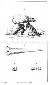
Wiltshire Archaeological Magazine 1913 V38 Pages 379-414. Preshute. 3a. The Dolmen known as the "Devil's Den [Map]," in Clatford Bottom. No recorded opening. This may be the chamber of a long barrow, or an erection never intended to be wholly covered, such as the standing stones at Littleton Drew (see under Nettleton).
It was considered to be the remnant of a barrow by the Eev. W. C. Lukis, and by Sir R. C. Hoare. The latter says of it: "From the elevated ground1 on which this monument is placed, it is evident that it was intended as a part annexed to the sepulchral mound, and erected probably at the east end of it, according to the usual custom of primitive times." It consists of a massive covering stone resting on several uprights, which appear to have given somewhat under the weight imposed upon them. There are also several other recumbent sarsen stones which no doubt formed a part of the monument, whatever its exact character may have been. 0.31. 28 SE.; A. W. II. 43; Smith p. 202—3, XV. K. v. a; Stukeley, Abury 49.
Note 1. This must refer to the artificial rising (the remnant of the mound) for it lies in a combe or "Bottom."
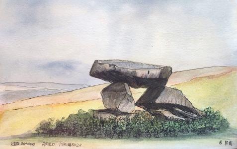 1981. Keith Dhán. Watercolour of the Devil's Den Long Barrow [Map].
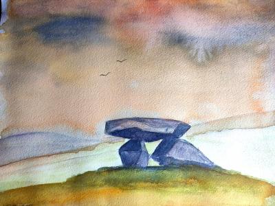 Around 2000. Keith Dhán. Watercolour of the Devil's Den Long Barrow [Map].