Biography of Micah Salt 1847-1915
Micah Salt 1847-1915 is in Antiquaries.
In 1847 Micah Salt was born in Alstonefield [Map].
In 1877 Micah Salt (age 30) and Maria Mellor (age 20) were married.
Proceedings of the Society of Antiquaries V16 1896 Dec 17. John Ward, Esq., F.S.A., communicated the following paper on some further excavations in barrows in the neighbourhood of Buxton, Derbyshire:
"Since the excavation of the barrows described in my last communication, Mr. Micah Salt (age 48) and his son have opened several more in the vicinity of Buxton, with results which well deserve to be brought before your notice. For the present I confine myself to two of these ; they are situated upon Stoop High Edge, a hill near Hollingsclough, 3 miles S.S.E. of Buxton, and the other (in the exploration of which I accompanied the Salts) upon Thirkel-low, a hill three miles S.S.W. of that Derbyshire town. Both have an elevation of between 1,400 and 1,500 feet above the sea level.
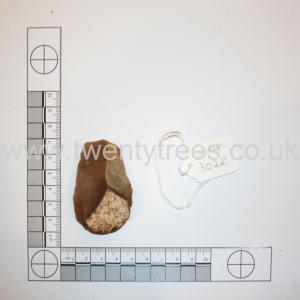
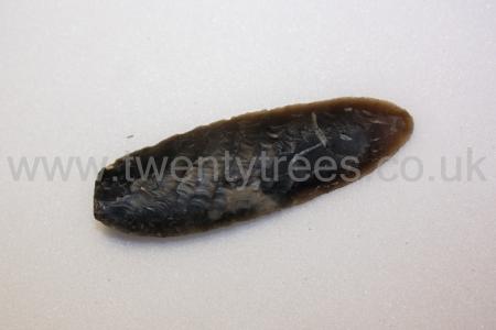
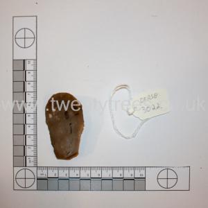
Between 1899 and 1901. Found at Five Wells Chambered Tomb [Map] collected by M Salt (age 52). In the collection of Buxton Museum and Art Gallery [Map].
 Flint Scraper
 Flint knife
 Flint tool or fabricator
On 22 Jan 1915 Micah Salt (age 68) died. He was buried at Buxton Cemetery. His gravestone is a replica of the Anglo-Saxon cross in Eyam Cemetery.
In 1927 [his former wife] Maria Mellor (age 70) died.
Bull Ring Henge [Map]. Historic England.
The monument is situated on the north-western edge of the limestone plateau of Derbyshire and includes, within a single area, Bull Ring henge and the adjacent oval barrow. Also included is the bowl barrow superimposed on the western end of the oval barrow. The henge has an external diameter of 93m by 90m and comprises a bank and internal quarry ditch surrounding an oval area measuring 53m from north to south by 46m from east to west. The steep-sided rock-cut ditch currently varies between 8m and 12m wide and between 0.5m and 1m deep. Partial excavations carried out by Alcock in 1949, demonstrated that, originally, it measured 5m to 6.5m wide and was between 1.2m and 2.1m deep. The surrounding bank is currently c.1m high and between 9m and 11m wide. It has spread since its construction, however, and was originally 2m high and 5.5m to 7m wide. It is broken by opposing entrances to north and south, each with a causeway across the ditch and each measuring c.9m wide. The northern example was damaged by quarrying in the nineteenth century, when a human skeleton was reputedly found. Between the bank and ditch is a berm or terrace which originally measured 5m wide and is clearly visible in the southern part of the site. Northwards, it becomes narrower and is finally obscured by the spread material of the bank. The interior of the henge contains the linear earthwork remains of eighteenth century ploughing which, to the west of the northern entrance, has partially levelled the inner edge of the ditch. Also during the eighteenth century, a drystone wall crossed the site and has since been removed though the line of it can still be seen as a gap in the plough ridges. Pilkington, writing in 1789, records that a single orthostat of a possible stone circle remained within the henge. This has gone and no investigation of the interior of the henge has been carried out to confirm whether or not a stone circle existed. In addition to Alcock's excavations of the ditch and bank, a minor excavation was carried out in the west ditch by Salt in 1902 and, in 1984, a larger excavation by Barnatt and others took place outside the south entrance. Material recovered by Salt has been lost but is reported to have included pottery sherds and flint flakes, while Alcock found further flint flakes and artefacts and a rim from a pottery food vessel. The 1984 excavation confirmed that the area south of the henge had been disturbed in the post-medieval period, but several pits and the stakeholes of a hurdle fence which followed the henge bank are undated and may be contemporary with the henge. In addition to post-medieval material and a sherd of Roman pottery, numerous flint flakes and implements were also found in this area. On the south-west side of the henge, c.20m distant, is a large mound interpreted as an oval barrow overlain on its western end by a later bowl barrow. It is sub-rectangular in shape and measures 27m by 21m by c.2.5m high. Originally it would have been somewhat higher but has been disturbed on the summit by a World War II slit trench. Its current plan is due to modern disturbance round its edges, caused by ploughing and the construction and later removal of drystone walls on its east and north sides. No recorded excavation of the barrow has been carried out so it cannot be precisely dated. However, it's position and form are analogous with those of Gib Hill: the superimposed oval barrow and bowl barrow at nearby Arbor Low henge. All modern walls and fences and the surfaces of the track and carpark round the outside of the monument are excluded from the scheduling although the ground beneath these features is included.