Europe, British Isles, North-Central England, Derbyshire, High Peak, Dove Holes, Bull Ring Henge [Map]
Bull Ring Henge is in Dove Holes [Map], Peak District Henges.
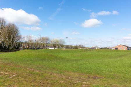
Bull Ring Henge [Map] is a Henge located in Dove Holes [Map] next to the church and cricket pitch. If it had a stone circle, which isn't certain, it doesn't any more.
The Bull Ring Henge [Map] and Arbor Low Henge and Stone Circle [Map] are so similar as to be considered twins notwithstanding the present absence of a stone circle at the Bull Ring.
Pilkington, writing in 1789, records that a single orthostat of a possible stone circle remained within the henge.
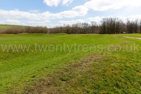
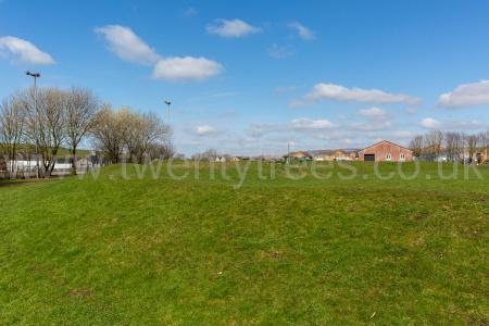
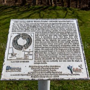

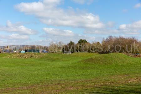


Bull Ring Henge [Map]. Historic England.
The monument is situated on the north-western edge of the limestone plateau of Derbyshire and includes, within a single area, Bull Ring henge and the adjacent oval barrow. Also included is the bowl barrow superimposed on the western end of the oval barrow. The henge has an external diameter of 93m by 90m and comprises a bank and internal quarry ditch surrounding an oval area measuring 53m from north to south by 46m from east to west. The steep-sided rock-cut ditch currently varies between 8m and 12m wide and between 0.5m and 1m deep. Partial excavations carried out by Alcock in 1949, demonstrated that, originally, it measured 5m to 6.5m wide and was between 1.2m and 2.1m deep. The surrounding bank is currently c.1m high and between 9m and 11m wide. It has spread since its construction, however, and was originally 2m high and 5.5m to 7m wide. It is broken by opposing entrances to north and south, each with a causeway across the ditch and each measuring c.9m wide. The northern example was damaged by quarrying in the nineteenth century, when a human skeleton was reputedly found. Between the bank and ditch is a berm or terrace which originally measured 5m wide and is clearly visible in the southern part of the site. Northwards, it becomes narrower and is finally obscured by the spread material of the bank. The interior of the henge contains the linear earthwork remains of eighteenth century ploughing which, to the west of the northern entrance, has partially levelled the inner edge of the ditch. Also during the eighteenth century, a drystone wall crossed the site and has since been removed though the line of it can still be seen as a gap in the plough ridges. Pilkington, writing in 1789, records that a single orthostat of a possible stone circle remained within the henge. This has gone and no investigation of the interior of the henge has been carried out to confirm whether or not a stone circle existed. In addition to Alcock's excavations of the ditch and bank, a minor excavation was carried out in the west ditch by Salt in 1902 and, in 1984, a larger excavation by Barnatt and others took place outside the south entrance. Material recovered by Salt has been lost but is reported to have included pottery sherds and flint flakes, while Alcock found further flint flakes and artefacts and a rim from a pottery food vessel. The 1984 excavation confirmed that the area south of the henge had been disturbed in the post-medieval period, but several pits and the stakeholes of a hurdle fence which followed the henge bank are undated and may be contemporary with the henge. In addition to post-medieval material and a sherd of Roman pottery, numerous flint flakes and implements were also found in this area. On the south-west side of the henge, c.20m distant, is a large mound interpreted as an oval barrow overlain on its western end by a later bowl barrow. It is sub-rectangular in shape and measures 27m by 21m by c.2.5m high. Originally it would have been somewhat higher but has been disturbed on the summit by a World War II slit trench. Its current plan is due to modern disturbance round its edges, caused by ploughing and the construction and later removal of drystone walls on its east and north sides. No recorded excavation of the barrow has been carried out so it cannot be precisely dated. However, it's position and form are analogous with those of Gib Hill: the superimposed oval barrow and bowl barrow at nearby Arbor Low henge. All modern walls and fences and the surfaces of the track and carpark round the outside of the monument are excluded from the scheduling although the ground beneath these features is included.
James Pilkington 1789. In one of my excursions into the Peak I discovered another ancient monument [Bull Ring Henge [Map]] of this kind. It is about twelve miles north from that, which I have now described. It is situated near the south-west side of Peak Forest. It lies about three quarters of a mile to the right of the road from Buxton to Chapel-en-le-Frith, and at the distance of about two miles from the latter place.
The area measures from east to west forty- eight yards, and fifty-fix in the contrary direction. The ditch is about six yards wide, and the bank six yards high and twelve broad at the base. All the stones, excepting one, are removed. Nor is there at present any mount near the opening, either to the north or south. Indeed there does not appear ever to have been one in such a situation. Nothing can now, however, be determined with certainty in regard to this point. For this ancient remain being situated in an inclosed part of the county has been considerably altered by improvements in agriculture. A wall has been carried across the area through the openings in the north and south parts of the bank. When I saw it, the west division of the area had been ploughed, and sown with corn.
Derbyshire Archaeological Journal Volume 30 1908 Page 155. [Fol. 43.] June 1st and 2nd 18241.
The large barrow [Gib Hill Barrow [Map]] situate 4 or 500 yds. from Arborlow, in a field called Gib hill [Map], belonging to Mr. Thos. Bateman of Middleton by Youlgreave, was opened by Mr W. Bateman (age 37), and myself, by driving a level through the S.E. side to the centre. The first covering which was about 2 yard in depth consisted of loose stones and earth, (but not so stoney as the Arborlow) under which a thin layer of tuft stone. Beneath this was a stratum similar to the first of about 1½ yards in thickness with a second thin bed of tuft stone. To this succeeded a stiff reddish brown clay, completely saturated with what we supposed to be animal matter, and having evident marks of fire. This clay was laid on the natural soil, about 1½ yds. in thickness, and 3 or 4 yards in diameter, and was throughout its whole circumference full of burnt bones and charcoal, disposed apparently in layers. A stratum of tuft stone which we supposed had been changed into a yellow ochry substance by the action of the fire, was placed under this; beneath which we penetrated to the solid rock 5 or 6 yds. in perpendicular height from the summit of the mount. We carefully examined the clayey stratum but could find no traces of an urn having ever been deposited; we found in the clay a small arrow head of flint, and a stone of somewhat peculiar shape, much broken, which might have been made use of as a hatchet2, some pieces of burnt bones (whether human or not cannot be ascertained) and a (very) few bones of rats were found3.
The mount has, no doubt, been raised over the funeral pile of some family, in which the bodies were entirely consumed, perhaps before the introduction of urn burial. The tumulus has evidently been connected with the adjoining temple by a small rampire of earth which runs Southward from the vallum of the Arborlow, round this barrow to the Westward; but may not be coeval with the original foundation of the temple. The remains found are in the possession of Mr. W. Bateman of Middleton.
One of the men employed in this excavation stated positively that he and a John Broomhead, had, under the direction of Mr. B. Thornhill, of Stanton, dug down into the centre of this barrow many years before, when they found the bones of a human hand, and several Coins, some of which were silver, and that on their arrival at some large stones, they desisted. The coins were taken away by Mr. Thornhill. The stones appear to have been considerably above the stratum of burnt bones, &c. mentioned. On Mr. Bateman's application to Mr. Thornhill on the subject, he denied having any recollection of opening the barrow at all.
Samuel Mitchell (age 21) Junior.
Note 1. Vestiges, pp. 31-2, and briefly in Ten Years' Diggings, pp. 17-20, in both of which the above exploration is attributed to Mr. W. Bateman only. These pages in Ten Years' Diggings record the opening of this great-barrow by Mr T. Bateman, January 10th-17th, 1848, when a huge cist containing burnt human bones and a vase were found near the summit.
Note 2. "A battered celt of basaltic stone"- Ten Years' Diggings, p. 20. In addition to the "finds" enumerated above, a small iron fibula was found in the upper part of the mound.
Note 3. Mr. Mitchell's account of the opening of this barrow is valuable, as his description of the construction is more detailed antl explicit than that of Vestiges, p. 31. The exploration of 1848 proved that the upper portion of the mound had been raised over four small ones of clay, placed square-wise. The present writer has recently suggested that these may simply represent the mode of constructing a square mound like that near the south-west side of the great circle at Dove Holes [Map], and that the upper material of stones and earth represents a subsequent enlarging of the barrow when the cist was introduced (Reliquary, 1908). Derbyshire has supplied other examples of barrows which have been raised or otherwise enlarged upon the occasion of later burials.
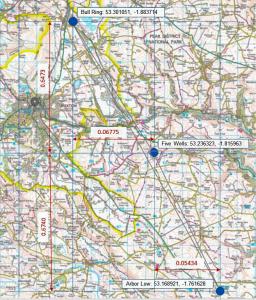
Arbor Low Five Wells Bull Ring Monument describes a possible prehistoric single monument formed from Arbor Low Henge and Stone Circle [Map], Five Wells Chambered Tomb [Map] and the Bull Ring Henge [Map] that form the same shape as the constellation Orion's Belt.
Other prehistric monuments including the Thornborough Henges, and, possibly, the Giza Pyramids appear to be similar. There are theories about there being a 'Cult of Orion' around 2400BC. Both Arbor Low Henge and Stone Circle [Map] and Bull Ring Henge [Map] can be seen from Five Wells Chambered Tomb [Map] albeit not with the naked eye during daylight - a camera with a long lens is needed. In darkness a bonfire would make both easily visible.
Taking the positions of each map from Historic England's listing the angle between the monuments is 172 degrees which is consistent with the angle of Orion's Belt. The angle of Orion's belt may have changed over time - difficult to find an exact figure. And, of course, difficult to be precise as to the centre of each monument so error is likely. I couldn't find a description of the linear distance between the stars seen from earth. If anyone has better information please email email@twentytrees.co.uk.
Derbyshire Archaeological Journal. The Stone Circle, known as the Bull Ring [Map], at Dove Holes, and the Mound [Map] Adjoining1. By Edward Tristram, F.S.A
Note 1. This paper, in a somewhat curtailed form, was read at the Meeting of the Annual Meeting of the Society, at Buxton, in 1912.